Visapur Fort monsoon trek – a thrilling waterfall trek

Visapur fort doesn’t often get the limelight. The neighbour, Lohagad Fort, is an extremely popular monsoon destination because of its history and also the relative ease of the climb. The climb to the top of Lohagad fort (not to explore the entire top though) would take around 25-30 minutes and it is almost completely on proper stairs, whereas the Visapur fort requires at least an hour of moderate climbing over rocks and mud trails.
Our Visapur Fort story is spread over four years. Our first attempt was in 2019. I wasn’t aware of the waterfall route then and took the route usually not taken in the monsoons. We reached to the fort walls, but couldn’t find the steps to get inside. The same year, i had the chance to go with a group in the winter. We took the waterfall route (complete dry). Then in 2023, we finally did the waterfall route during the monsoon and it was an amazing experience.

Route to Visapur fort base: Two routes. One more on the highway and another, slightly longer, but more scenic.
The highway route: Straightforward from Pune on the old highway. Take the exit to Malvali village (little before Lonavala). Once you cross the village, you will see Bhaje Caves. Cross that and climb towards Visapur. This 7 km stretch is steep with lot of hairpin bends and poorly maintained (marked in a blue circle on the above image). If you have no experience driving on steep roads, avoid this route. Lot of cars get stuck on the turns. So, they leave the cars and walk the rest of the way (a waste of time and energy).
The scenic route: Go to chandni Chowk, get the on the Mulshi road. From Paud, take the turn towards Tikona fort. Cross tikona fort and Pawana Dam and then you should take the turn to Lohagad base. A little ahead of Lohagad base is the Vispur fort base parking.
Highway Route (from Magarpatta City) –> https://maps.app.goo.gl/96G7dYhvNVMKAf996
Scenic Route through Pawana Dam –> https://maps.app.goo.gl/xREm623zhmEmUnYi8

..

Our first attempt was on Aug 15th, 2019. We took the route marked as (1) on the map above. It starts just behind the ticket counter of Bhaje caves (after you climb the steps from Malvali) and then proceeds until it hits the route (2) eventually leading the famous “stairs with water flowing on it”. Route (2) starts from Patan village and is in general not advised as the trail is not clearly marked and goes through forested areas making navigation difficult.

We were relying on satellite view and trying to make our way in the “direction of the fort”. The views were amazing, but we also ended up taking lot of wrong turns with some taking us to narrow ledges over waterfalls (quite risky)

..

At the end, after 5.5 hours, we came back to the start of the trail having just managing to “touch” the fort walls. Was an amazing experience though.

The second attempt was through the waterfall route (3) with a group. It was December though and the entire route was stark dry. But it did help me that i got to know the waterfall route. The contrast in the trail between the winter and monsoon months can be seen in the images below.

..

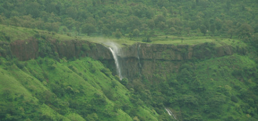
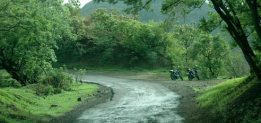
The third attempt happened few years later, in 2023. The waterfall route is clearly visible nowadays. There is a big parking and then a board points you away from the main road towards the trail. You have to walk through slush for around 20-30 mins mins before you hit the waterfall stretch. Then begins the thrilling exprience!

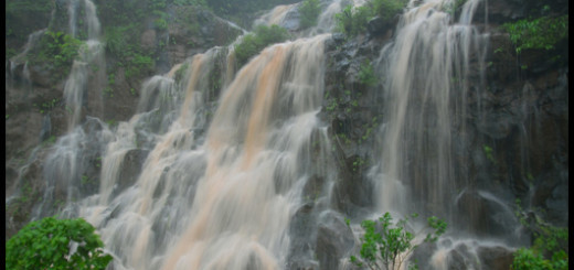
You are actually climbing up a waterfall route. The entire route is full of rocks, big and small. I am surprised that this is the most popular route and we haven’t had any rocks slip and roll down the path. When we climbed, it was raining, but not very heavy. So, we had water flowing down the rocks as we climbed. It was a very unique experience. Make sure that you wear proper climbing shoes or floaters. Normal slippers would just not work in these water+rock conditions.

..

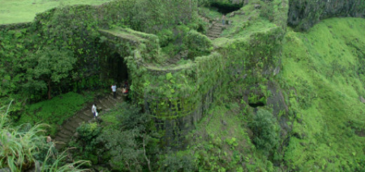
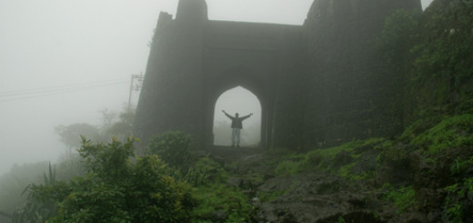
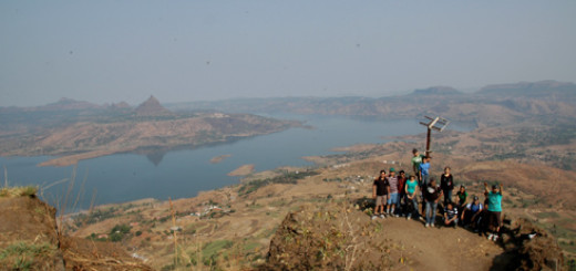
We spent close to an hour exploring the top of the fort including the famous stairs. These are at the other end of the fort (the place where route (2) meets the fort). But trails are very clear (with boards) on top of the fort. The villagers even setup temporary food stalls at the top (gpay accepted!). It had started raining heavily and the mist made the views amazing. There are lot of points to see on top including many ruins, few ponds and a temple.

Due to the heavy rain, the water flowing down the waterfall route increased a lot and it became very muddy. That is why you see the water as brown in the pictures below (when we climbed down) while it is normal in the pictures above (when we climbed up).

..

I would highly recommend this trek. It is not very easy as it involves clambering over rocks and one needs to be careful, but it is not tough either as the distance is short. But the experience is very unique and will be remembered for long. Do not go on a very rainy day as it can make the climbing difficult. If you have energy left after this climb, you can also visit Lohagad fort next door!