Trek to Lohagad fort near lonavala
A beautiful fort in a beautiful location, good roads to the base and an easy climb make Lohagad fort one of the more popular destinations to visit close to Pune. But thankfully, it has survived the commercialisation and the mess that Sinhagad fort has been subjected to. The fort is still in a good condition and relatively clean. Many of the structures on the fort are still intact and climbing the fort would give you the feeling of actually climbing a fort rather than walk on “made in 21st century” concrete steps!
How to go to Lohagad fort from Pune: There are multiple approach routes to go to Lohagad fort, each of them unique in what the route presents.
Though Malvali Village/Bhaja Caves: This is the route taken by all the trekking groups and the one which doesnt need the use of a personal vehicle. Go to lonavala by the local train. Take another local to go to Malvali village. From Malvali village station, it is a walk of around 2 kms to Bhaja village, the base village for Bhaja caves. An upward path (stairs) would take you to Bhaja caves, but if you follow the winding path (wide enough for a car) next to the stairs, it would take you to the village of Lohagadwadi, the base village for Lohagad fort. This route is around 5-7 kms long and would take around 2-2.5 hrs on foot. But, if you have a vehicle, you can drive on this road (unless the rains have been very heavy) and go to the base village. If you want to drive to Bhaja village, check out the direction in the other post of Bhaja caves. I would prefer this route to come down from Lohagad as it is very steep with sharp hairpin turns annd many vehicles get stuck while climbing. The preferred route would be to go through Pavana (third option below) and come back through Malvali.
Through the Mumbai-Pune Expressway: This is the fastest way to reach the base village. Go on the expressway from Pune. When the Sinhagad institute appears on the side of the highway, look out for an exit from the road. This is not very obvious though. Get off the exit, go under the highway and enter into a village. If you are doubtful as to whether this could be the route through the village, then you are on the right track! Once you cross the narrows lanes of the village, take a right onto the main road and travel 5-6 kms until you reach a junction where there are lot of tea shops. if in doubt, ask anyone for the route to Lohagad. if you have Google earth, download this kmz file, this will show you the route from the village to the junction. At this junction, take left to go to the base village.
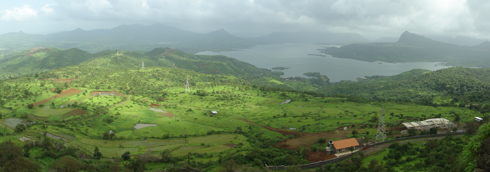
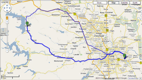
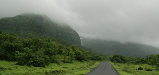
Through Pavna Dam and Dudhiware Khind: This is the route i took when i went to Lohagad. I returned through the 2nd option(highway). This was one of the greenest routes i have ever driven on. Pavna dam and Tung fort in the background (separate post) were a sight to behold. Go to Chandi Chowk. Then cross Pirangut. Once you reach Paud, you will see a junction. On this junction, turn right towards Pavana dam or ask anyone in Paud for directions to Pavna dam. This is one straight road and you cannot get lost. You will drive through pristine villages and there is greenery all around (during monsoons!). The climb down to Pavna dam is awesome. Once you cross Pavna dam, you will come to a T-junction. Taking the right will take you back to Kamshet and Nh4. Take the left and climb up towards Lohagad. On this road, you will cross Dudhiware Khind, a pass cut through the mountains. It is eerie as well as amazing to drive through this pass, particularly when it rains. Given below is a snapshot of the route i took.
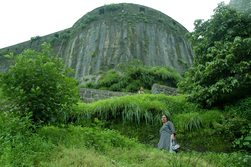
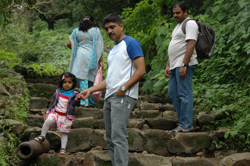
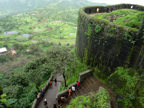
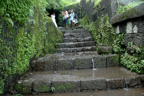
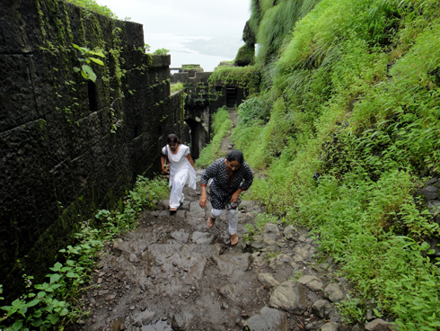
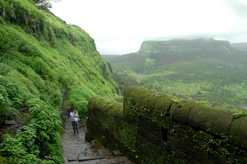
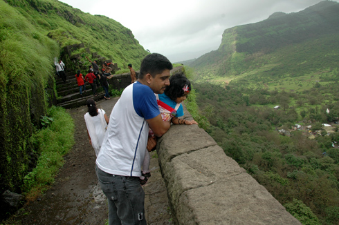
The climb to the top of the fort should take around 20-25 minutes without any photo-stop. But, you just cannot pass by such scenery without stopping. So, allow anywhere from 45mins – 1 hr to reach the top. There are steps for most of the way, but they are of stone and pretty big and sometimes uneven. But, this is what adds to the fun. Also, during the rainy season, water flows on the steps making them a bit slippery.
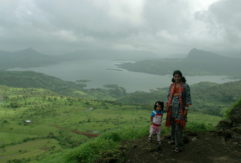
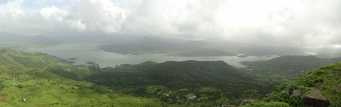
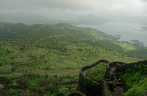
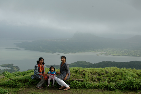
The adjoining Visapur fort is visible for most part of the climb. There are panoromic views at many points on the way up. You get to see the pavna dam backwaters and even the tung fort at many places.
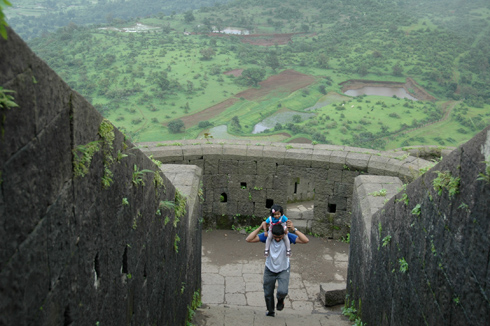
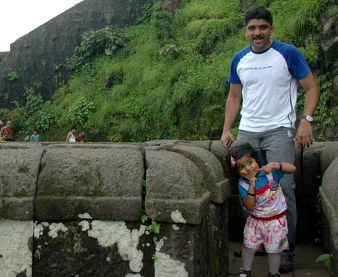
Akshara enjoyed the walk up as it was also slightly drizzling throughout. Only concern was her constant wish to go/see “keezha” (downwards). She wasn’t ready to move from many viewpoints until she got a first-hand look of what was below!
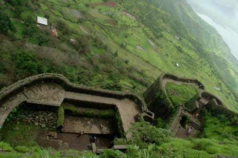
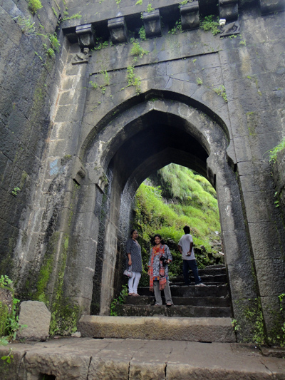
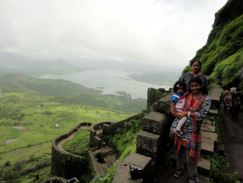
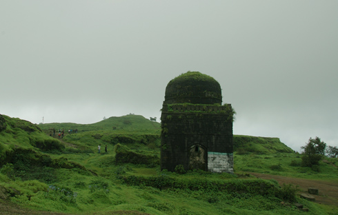
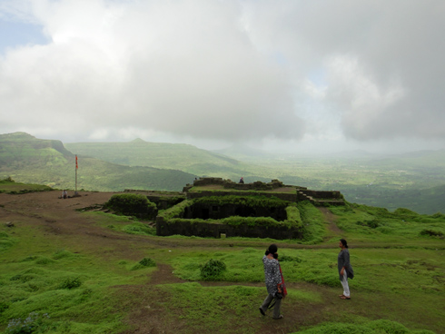
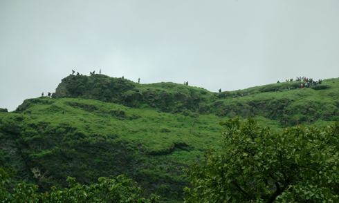
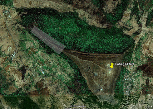
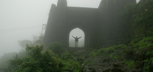
The top of the fort is quite expansive and offers uninterrupted views in all directions. The highlight of Lohagad is its Vinchukata fortification (resembling a scorpion’s tail). This structure juts out from the main section of the fort and requires an additional 15-20 mins of walking to reach the edge. We didnt go for this as were pressed for time, but you can see in the last-but-one pic below (taken from the bottom), people walking on a narrow ledge towards this structure. The last pic is from google earth showing this feature (the shaded region)


Jay, the route marked in the map above shows that. You can go through Pavana dam and reach the base village by road.
Nice photos and very well written….i have been to lohgad several times,but unfortunately haven’t discovered the road via car directly to the foothills of the fort.i am sure there is a way,but couldn’t find it.could you help me with that please.
Though Malvali Village/Bhaja Caves
In option 1 , you cannot drive a 4 wheeler, road is
horrible and for walking purpse only.
High chances of tyre cut since all stones are on this route till you reach base village
After say 1.5 kms , on some turns , road is in very bad condition and even innova or qualis not able to travel
on that so you have to park your vechile at the bhaje caves parking lot only.
I saw few people tried yestarday in cars to drive but after max 1 km , they have to prak thei cars as
road was not at at all in drving condition
I came back yestarday only and in monsoon . some turns are in dangerous condition now
and high chances of vechile damage if you ever try this malavali-bhaje caves route on vechile
I had recently been to Lohagad . Fantastic place it is indeed . The exit on the Sinhagad college wasnt know to us until I read your direction. We went to Lonavla and through the market we went to lohagad . Yes indeed we saw the SInhagad institute on the way and wondered if there is any road from here to Lohagad directly.
A must go trip in the monsoon time ….
Nice photos ….
Thanks for the perfect route description. We followed the Mumbai-Pune expressway. Nice place/fort.
of course!
1) not sure abt that, as the route is not for regular vehicles.
2) yes, if u go on old highway, malvali is before lonavala
1) Is there any transport available from bhaja village to lohagadwadi? i.e, 5-7kms…
2) while going from pune to lohghad, i think malvali comes before lonavala right?
Dear Rajaram,
Any crowd on saturday & sundays?
this is very help full website before planing to any trip think every bady has to visit this site its realy wonderfull site
thanks to Rajaram